Here are just a few startling images from the recent “polar vortex,” when temperatures around the northern half of the US plummeted to record lows—in some places to minus 40 and counting. What WAS the polar vortex, exactly? It was an elliptical-shaped pattern of low-pressure, fast-moving winds that typically swirl around within the Arctic Circle. It’s not uncommon for tendrils of the vortex to reach the US in winter, but this year a large swath swooped down. Climate change may partly explain this phenomenon: the Arctic is heating faster than the rest of the world as more and more sea ice melts. Bright white ice reflects energy back to space, while dark blue water absorbs it, so as more ice melts, the water warms at an increasing rate, lessening the temperature difference between the Arctic and North America and causing a wobbliness in the jet streams that usually keep these channels of air separate.
Blue skies mean the snow’s over. Clouds, made up of tiny water droplets and ice crystals, usually turn gray before snow or rain because not all visible light is making its way through the unusually dense cloud. Credit: Shutterstock/Stephanie Barbary
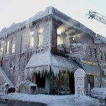
In this photo, water freezes on contact with a building that caught fire in subzero Nebraskan temperatures. In cold climates, fire hoses should always have a small amount of water running through them because moving water does not freeze readily. Credit: AP Photo/Nati Harnik
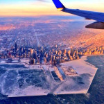
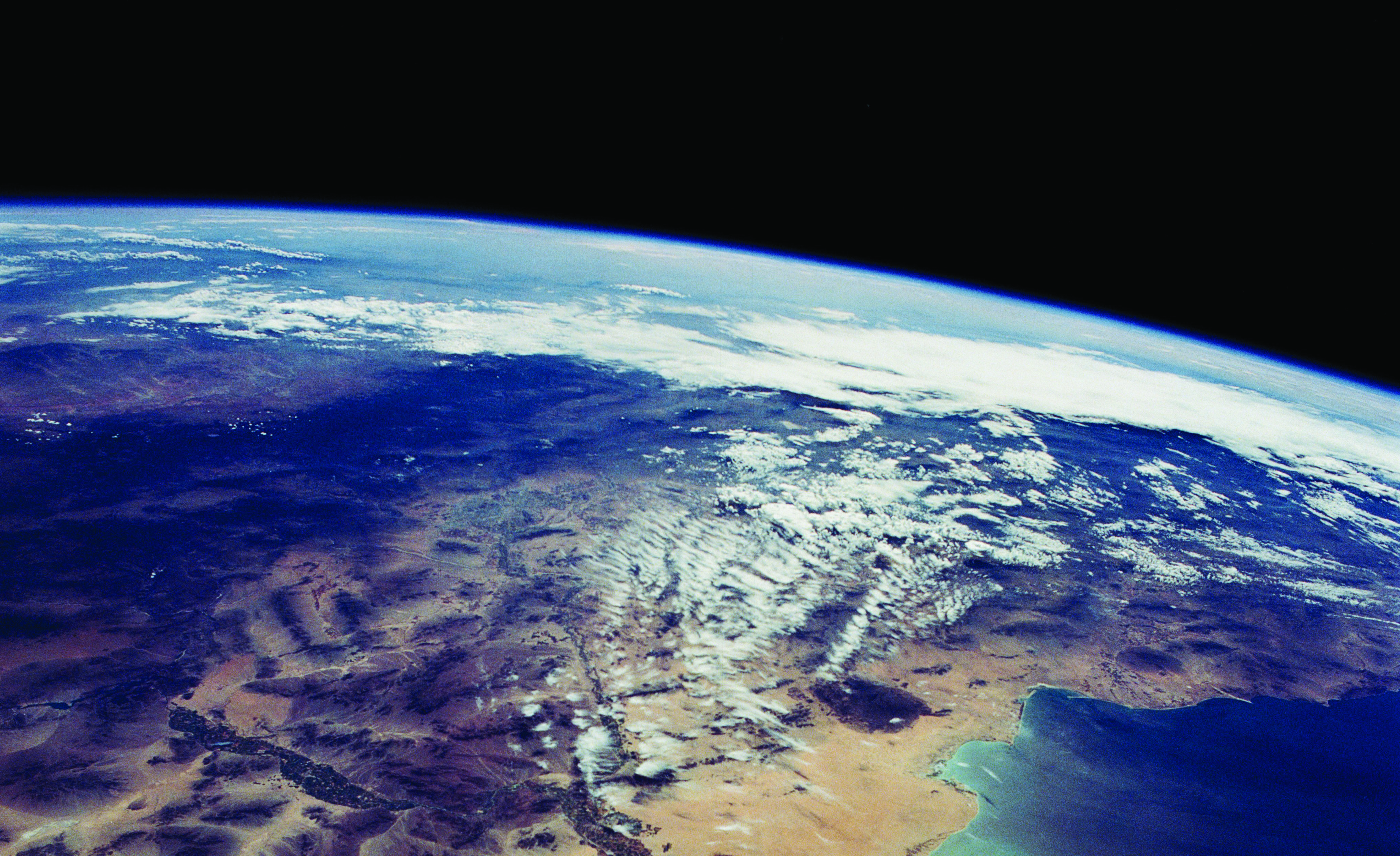
The blanket of snow that covers the Midwest and New England in this satellite image is atypical because it occurred in such cold temperatures. Snow becomes less common and less plentiful as ground level temperatures sink below zero, because there is less water vapor in the air; winter storms transpire when two air masses of different temperatures and moisture levels mix. Credit: NASA
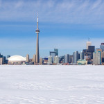
While miles of shoreline froze during the polar vortex, it would take a lot more for Lake Michigan to freeze over entirely. If this were to happen, among other things, it would negate “lake effect” snowfall, which occurs when a mass of sufficiently cold air moves over a body of warmer water, creating an unstable temperature profile. Credit: Hank Cain via @WCL_Shawn
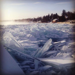
Lake Superior’s jagged shoreline, as ice piled up in struggling waves because ice is less dense than water and floats to the surface when it forms. Credit: Reddit user Dirtyflowerz
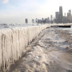
Icicles, like those seen here at the shore of Lake Michigan, formon days when the outdoor air temperature is subfreezing, but sunshine warms and melts some of the ice. As the water drips, it loses heat to the cold air and refreezes on the way down, creating the classic icicle structure. Credit: Getty/Scott Olson


Comments